JACK'S BLOG
|
|
|
5/1/2012 3 Comments Follow Me After YouInfantry SchoolSOMEONE ONCE SAID “never trust a lieutenant with a compass or a captain with a rifle.” Neither is safe to be around. A battlefield is not a safe place to wander around lost, nor is it safe to have the man behind you shooting, and generally, that's where you'll find a captain -- behind you. 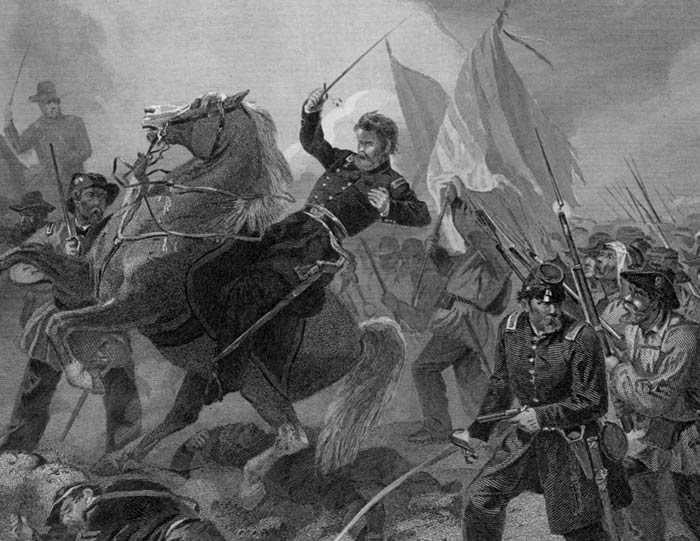 "Nothing is so good for the morale of the troops as occasionally to see a dead general." Field Marshall Slim Once upon a time, military leaders actually “led” their men into battle. Even generals mounted their warhorses and rode in front of massed ranks of armed men marching at each other. However, modern American infantry tactics dictate that enlisted men lead the way while the officers lead from behind. This is not a matter of cowardice. Think about it. It's virtually impossible to monitor your forces and correct their maneuvers and actions when they are behind you unless, of course, you have eyes in the back of your head. However, at the time I was in Officer Candidate School, we learned that Israeli lieutenants led their men into battle – literally, they led them. Of course, their platoons used an entirely different set of assault tactics. An American infantry platoon in the assault advances to the “line of departure” in a file formation, then spreads out in a single rank parallel to the enemy. After artillery and airstrikes “soften” the enemy defenses, the platoon advances in one parallel rank towards the enemy's line of defense with the platoon leader following behind to observe the action and make adjustments to take advantage in weak points or fill in when his men fall. 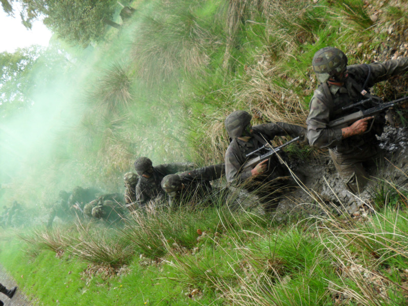 Israeli infantry advancing in single file We learned that the Israeli's infantry advanced in a single file all the way to the enemy line with the platoon leader in front. Their goal was to pierce the enemy defenses – to create a hole in them. Each side of the break would then become an unprotected flank that the platoon could attack, spreading out to make the hole larger until the defense crumbled. Whereas an American infantry lieutenant had the life expectancy of a housefly, I can only imagine that his Israeli counterpart must have survived as long as the flame of a match in a hurricane. Regardless of the tactics and strategies employed, infantry units need someone who knows where they are and how to get where they need to go. It's also important so they can accurately direct fire from artillery and air forces, or request resupply or medical evacuation. Thus, we spent a lot of time in OCS learning Land Navigation. Fortunately for me, I was a experienced navigator and had won several competitions testing my skills navigating at sea. Navigating on the land is very similar. It requires only one additional skill: The ability to interpret contour lines on a flat map and see a three-dimensional view of hills, mountains, gullys, canyons, and ridges. Of course, I ended up in the Mekong Delta where there wasn't a contour in sight. 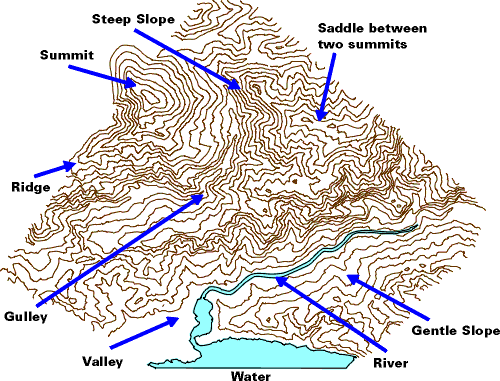 We worked in teams during our early lessons but, before we graduated, we were working individually. We wouldn't be able to navigate by committee once we were leading a platoon in combat. We learned how to interpret aerial reconnaissance photos as well as how to read maps. Much of the world, even today, has not been accurately mapped. We learned how to use a compass and orient a map. Once a map or photo is aligned with the land (north on the map faces true north) all the features on the map or photo will be arranged around you exactly as they appear on the map. 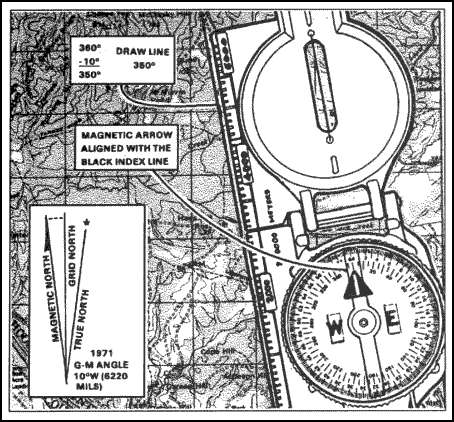 Orienting a map We practiced both at night and during the day, finding our way from one point to another. The finish line was marked by a series of numbered posts about the diameter of telephone poles sticking up about waist high. The trainers noted the number of the post where you crossed the line after following directions, circumventing obstacles, and crossing uneven terrain. You were graded on how closely you arrived at the post where you were supposed to arrive.
I must have done well. They wanted me to remain at the Infantry School after graduation to teach Land Navigation. It didn't hurt that I once astonished the instructors when I proved that they could accurately determine their location with the aid of only one point of reference. They had been taught that you needed two and by taking a bearing with your compass on each, you would find your location on the map where the two bearings crossed. I showed them how to take a bearing on an object, move to another location and take a second bearing. It was simple then to draw a third line on the map showing the direction and distance you had moved. The three lines formed a triangle. At one corner was the object you had sighted. The other two corners represented you location: One where you had been when you took the first bearing, and the second where you now were. Unfortunately for the Infantry School and the Land Navigation program, my orders to report in Vietnam didn't allow time for me to stay there and teach. I remembered all these lessons and experiences as I wrote Rebels on the Mountain. I cannot imagine that Castro had access to maps or aerial photos of the Oriente Province where he fought most of his revolution. However, his lieutenants, especially Celia Sanchez, recruited from the outcasts and outlaws who lived there. These men and women must have brought invaluable local knowledge with them that helped the Fidelistas navigate the countryside.
3 Comments
James McAllister
5/2/2012 12:24:17 am
Seems like the Israeli platoon is always "getting its T crossed”. Once the tactic is know, they are vulnerable to be lured into a trap. 5/2/2012 12:40:37 am
Once upon a time, generals did lead their men into battle. Now they've grown smarter. They send men into battle and remain behind where the bullets aren't flying. That's why battles are won and lost, wars are won and lost, by boys who follow orders instead of making them. 5/2/2012 07:29:28 pm
I found the Native way of fighting most interesting. The leader in battle was leader based only on the consent and respect of his warriors. They considered themselves free men and the moment a leader was no longer deserving of that respect, his warriors left him. It made for very capable and powerful chiefs and very self-responsible warriors. Your comment will be posted after it is approved.
Leave a Reply. |
|
Copyright © 2000, 2001, 2002, 2003, 2004, 2005, 2006, 2007, 2008, 2009, 2010, 2011, 2012, 2013, 2014, 2015, 2016, 2017, 2018, 2019, 2020, 2021, 2022 Jack Durish All rights reserved
|
Web Hosting by iPage
|